Last updated: November 1, 2026
Affiliate Disclosure: Shelter Tactics is reader-supported. When you buy through links on this page, we may earn a commission at no extra cost to you. As an Amazon Associate, Shelter Tactics earns from qualifying purchases. Learn more.
The short answer: Your phone’s GPS does not need the phone network — it listens to satellites, so with offline maps downloaded it still knows where it is until the battery dies. What actually leaves people lost is a dead battery, map tiles that never downloaded, and no paper backup. The fix costs almost nothing: a printed map of where you live and drive, a baseplate compass with the declination set for your area — the correction runs about 15 degrees each way across the US, and skipping it puts you roughly a quarter-mile off course in a one-mile walk — and one printed sheet of contacts, addresses, and meeting points, kept in the glove box and the bag.
What actually stops working, and in what order
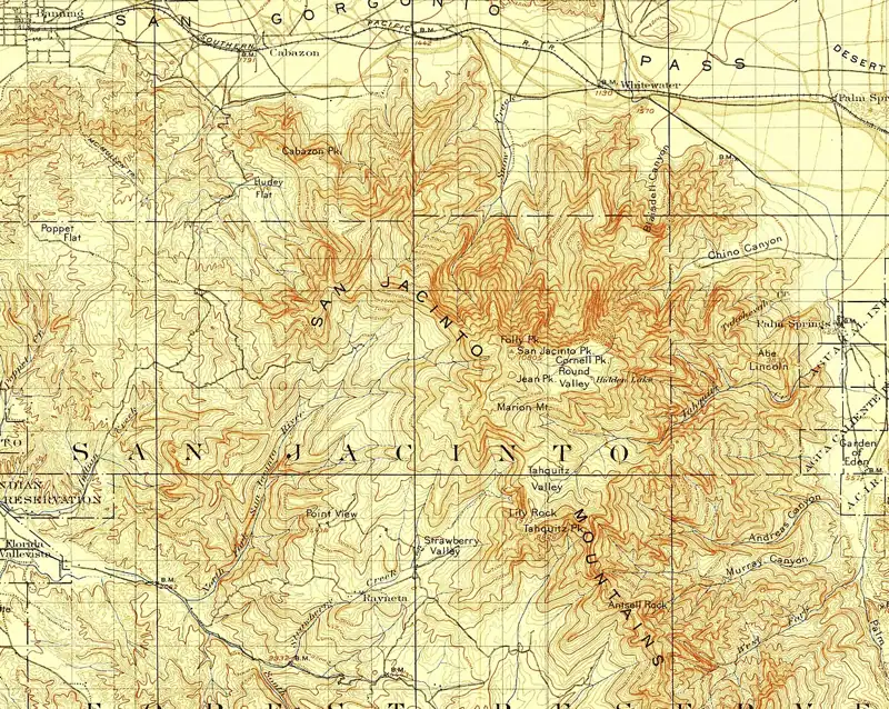
Three different things get lumped together as “GPS is down,” and they fail for different reasons. First to go is usually the battery: navigation is one of the hardest drains on a phone, screen up and GPS running, and a phone at 20 percent in the morning is a paperweight by afternoon. Second is the map itself. The blue dot is satellite work, but the streets under it stream from the network — lose data and most map apps show your dot wandering a blank grey grid. Third is the network: no calls, no texts, no way to tell anyone where the dot is.
Actual interference with the satellite signal exists, and it is worth one honest paragraph rather than a headline. Sweden’s transport agency counted GPS interference incidents over its region rising from 55 in 2023 to 733 in 2025, concentrated around the Baltic, aimed at aviation and shipping. That is a real trend in one contested corner of Europe. For a household in the US, the version of this problem you will actually meet is duller: an outage, a storm, a dead phone, a canyon or a parking garage. The preparation below covers all of those, including the exotic one, because paper does not care why the signal stopped.
The one number that decides whether a compass helps: declination
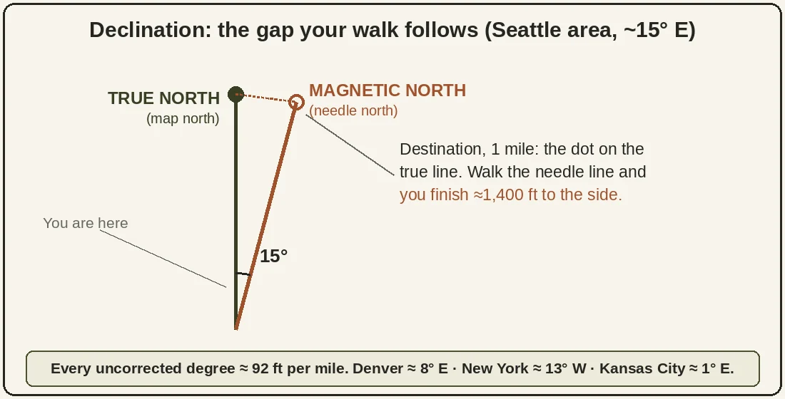
A compass needle points at magnetic north. Your map is drawn to true north. The gap between them is called declination, it changes depending on where you stand, and in most of the US it is big enough to walk you past your destination. The error grows with distance: every degree of uncorrected declination puts you about 92 feet off course per mile walked.
| Where you are | Declination (about) | Off course in 1 mile if ignored |
|---|---|---|
| Seattle area | 15° east | ~1,400 ft |
| Denver area | 8° east | ~740 ft |
| New York area | 13° west | ~1,200 ft |
| Kansas City area | 1° east | ~90 ft |
Those are rounded 2025 figures — NOAA’s free magnetic field calculator gives the exact value for your address, and it drifts a little each year, so a number you set a decade ago is worth re-checking. This is the whole reason the compass picks below are built around one feature: declination you can set once and forget, instead of arithmetic you have to redo at every bearing, in the rain, with cold hands.
Paper maps: the one supply you can no longer buy on the way
Almost everything else on a preparedness list can still be grabbed at the last minute somewhere. A map cannot. Gas stations and grocery stores used to keep a rack of folded state maps beside the register; that rack is gone — everyday retail stopped stocking paper maps years ago, because phones ate the demand. So on the one day the phones stop working, there is no store to stop at and fix it: the map has to already be in the car. What replaced the rack is ordering ahead — maps are bought online now, on a calm day, the way you stock batteries. That is the whole argument for treating a map as a supply you hold, not an errand you run.
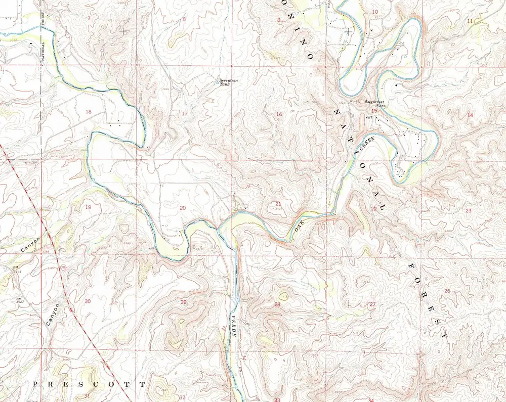
Three kinds cover the ground. A road atlas is the driving layer: the whole country between two covers, a spread per state, insets for the cities you would otherwise circle lost. A state gazetteer is the home-ground layer: topographic detail for one state — back roads, dirt roads, trailheads, boat ramps — the book that knows your county the way you do. And the USGS topographic quad is the walking layer: 1:24,000, where one inch equals 2,000 feet and one sheet covers about 55 square miles. The quads are free PDF downloads from the USGS — print the one your house sits on and the ones along your routes out, at home or at the library, for the cost of paper and toner. A phone photo of a map is not a paper map; it dies with the battery, which is the failure you are planning around.
Rand McNally 2026 Road Atlas
DeLorme Atlas & Gazetteer
The printed sheet: contacts, addresses, meeting points
One page, three copies — glove box, bag, kitchen drawer. Phone numbers written out as numbers, because a contact list hides the digits behind names and your contacts live in the phone that just died. Home, work, and school addresses. Two meeting points: one near the house, one across town, for the day nobody can call anybody. And two routes home that do not share the same bridge, tunnel, or stretch of interstate. This sheet gets refreshed on the same twice-a-year schedule as the rest of the bag — see how often should you check and rotate a bug-out bag? — because a sheet with your old address and a dead phone number is worse than none: it looks finished.
Compass basics: the three moves
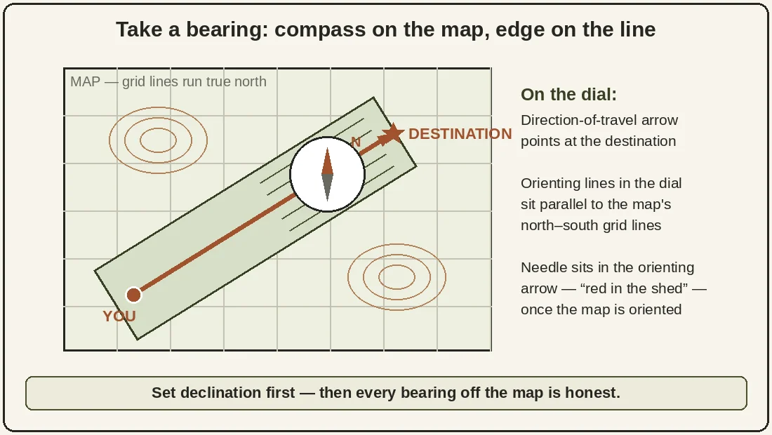
Set the declination first. Look up your value, then either dial it into the compass (the adjustable picks below hold it permanently) or note it on the map itself in pencil. Every bearing after that is honest.
Orient the map. Lay the compass on the map, line its edge up with the map’s north-south grid lines, and turn the map and compass together until the needle sits inside the orienting arrow — red in the shed. The map now faces the same way as the ground does, and features on paper sit where they sit in front of you.
Take a bearing. Put the compass edge on the map from where you are to where you are going, turn the dial until its north lines match the map’s, then lift the compass, hold it flat, and turn your body until the needle is back in the shed. The direction-of-travel arrow now points at your destination. Pick a landmark on that line, walk to it, repeat. That is the entire skill at the level a bad day requires — the rest is practice, and a Saturday afternoon with a local map is enough of it.
Brunton TruArc 3
Suunto A-10
Suunto MC-2
Your next step: the voice half of the same problem
Navigation is half of a dead-phone day. The other half is reaching people — and that half runs on radios, which need no network at all. The questions readers ask about them are collected in What People Are Asking About GMRS Radios, the honest range numbers for your terrain are in the Two-Way Radio Reality Check, and the license that makes a family legal on GMRS is one $35 application with no exam — walked through in GMRS Radio License, Explained Plain. Paper gets you home; a radio tells someone you are coming.
Questions readers ask next
Does my phone’s GPS work in airplane mode?
Yes — the GPS receiver is separate from the cell radio, and on most phones it keeps working in airplane mode. What airplane mode cannot give you is map data you never downloaded, which is why the offline download of your home region has to happen on a calm day, at home, on Wi-Fi. Do that once and the phone becomes a decent backup navigator instead of a blank grid.
How do I find the declination where I live?
NOAA’s magnetic field calculator — free, online, takes an address or ZIP and returns the current value. The margin of every USGS topo quad also prints it, but alongside the map’s year: the needle drifts year by year, so a quad printed in 1990 carries a 1990 number. Trust NOAA’s current figure and pencil it onto the map.
Will a compass work in a car, or near power lines?
Not reliably. A steel car body bends the needle’s reading — sometimes by enough to matter — and power lines, rail tracks, even a knife or phone in the same hand can pull it. Take bearings standing a few paces from the vehicle, compass held flat and away from metal, and if two readings disagree, step further away and take a third. The needle is honest; its surroundings lie.
What scale of map do I actually want?
On foot, 1:24,000 — the USGS quad — where trails, contours, and buildings all show and one inch is 2,000 feet. For driving out of a region, that scale is useless; you want a state atlas or highway map at the other end of the range, where one sheet shows a county. Most glove boxes should hold both: the quad for the last miles home, the atlas for the first hundred.
More questions like this: this page is one answer from What People Are Asking About GMRS Radios — the full set of signal-and-radios questions, with the short answers, lives there.
Keep reading
This answer belongs to What People Are Asking About GMRS Radios, our hub for the communications questions readers actually type, inside the wider Safety & Communication section. Check what a radio really reaches in your terrain with the Two-Way Radio Reality Check, and keep the printed sheet current on the schedule in how often should you check and rotate a bug-out bag?
Talk it over with other readers. The Shelter Tactics Community on Facebook is where readers compare notes on knives, lights, packs, and the rest of the kit — and where your questions help decide what we research next. Join the group →